Historical collections

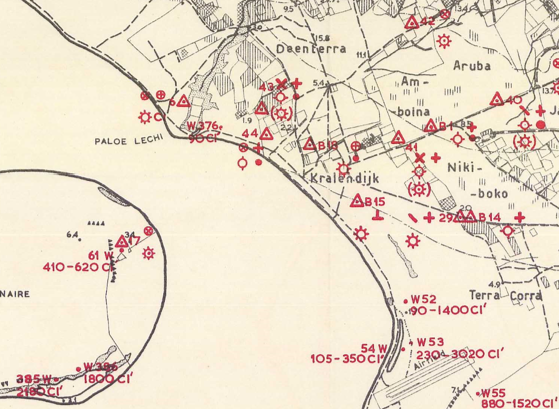
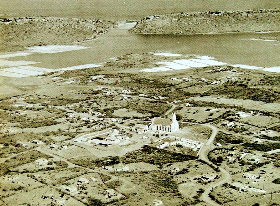
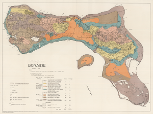
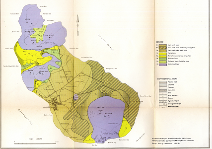
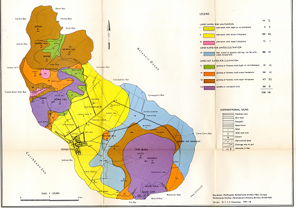
Historical land use and sample location map of Bonaire

The photo-geological observations and land capability's land use survey of the island of Bonaire shows
1. topographical features and land use data based on aerial photographs (year of photography 1949)
2. location and analysis of soil and water samples

Date
1956
Data type
Maps and Charts
Theme
Research and monitoring
Geographic location
Bonaire
Image

Photographs of Curacao (1971)

Het luchtfotoboek "Curaçao in Vogelvlucht'' met meer dan 200 zwart/wit foto's van het hele eiland zijn gemaakt in de jaren '60.. Het boek is in 1971 verschenen. In minder dan 3 maanden was het boek geheel uitverkocht.

Order the book at: http://www.curacaoinvogelvlucht.nl/ or contact the DCBD administratorfor more information.

Date
1971
Data type
Other resources
Theme
Education and outreach
Geographic location
Curacao
Author
Image

Historical Geological map of St.Eustatius

The historical geological map of St.Eustatius is produced by the Netherlands Antilles Development advisory bureau (Amsterdam) for the foundation of the welfareplan for the Netherlands Antilles (1946, Curacao) at a scale of 1:25.000

Date
1951
Data type
Maps and Charts
Theme
Research and monitoring
Geographic location
St. Eustatius

Historical land capability map of Bonaire

Historical land capability and land use map of Bonaire at a scale of 1:40.000. Based on aerial photographs of 1949 and a field survey from 1952-1953.
The download includes a hi-resolution scan of the original paper map and a geo-referenced version for use in GIS.

Date
1956
Data type
Maps and Charts
Theme
Research and monitoring
Geographic location
Bonaire
Image

Historical Soil map of St.Eustatius

The land capability map of St.Eustatius is produced by the Netherlands Antilles Development advisory bureau (Amsterdam) for the foundation of the welfareplan for the Netehrlands Antilles (1946, Curacao) at a scale of 1:25.000.

Date
1951
Data type
Maps and Charts
Theme
Research and monitoring
Geographic location
St. Eustatius
Image

Historical land capability map of St.Eustatius


The land capability map of St.Eustatius is produced by the Netherlands Antilles Development advisory bureau (Amsterdam) for the foundation of the welfareplan for the Netehrlands Antilles (1946, Curacao) at a scale of 1:25.000.

Date
1951
Data type
Maps and Charts
Theme
Research and monitoring
Geographic location
St. Eustatius
Image

Historical Soil map of Saba

The land capability map of Saba is produced by the Netherlands Antilles Development advisory bureau (Amsterdam) for the foundation of the welfareplan for the Netehrlands Antilles (1946, Curacao) at a scale of 1:25.000.

Date
1951
Data type
Maps and Charts
Theme
Research and monitoring
Geographic location
Saba
Image

Historical land capability map of Saba

The land capability map of Saba is produced by the Netherlands Antilles Development advisory bureau (Amsterdam) for the foundation of the welfareplan for the Netehrlands Antilles (1946, Curacao) at a scale of 1:25.000.

Date
1951
Data type
Maps and Charts
Theme
Research and monitoring
Geographic location
Saba
Image