Central repository for biodiversity related research and monitoring data from the Dutch Caribbean
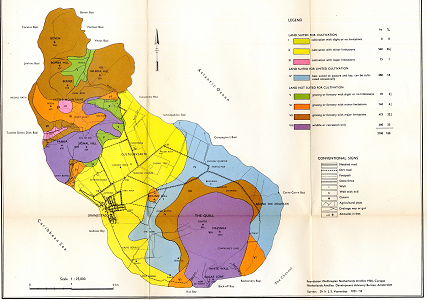
The land capability map of St.Eustatius is produced by the Netherlands Antilles Development advisory bureau (Amsterdam) for the foundation of the welfareplan for the Netehrlands Antilles (1946, Curacao) at a scale of 1:25.000.
Back to search results