Historical collections

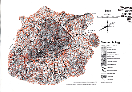
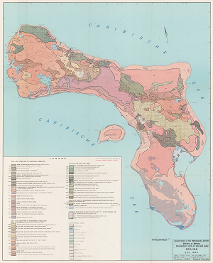
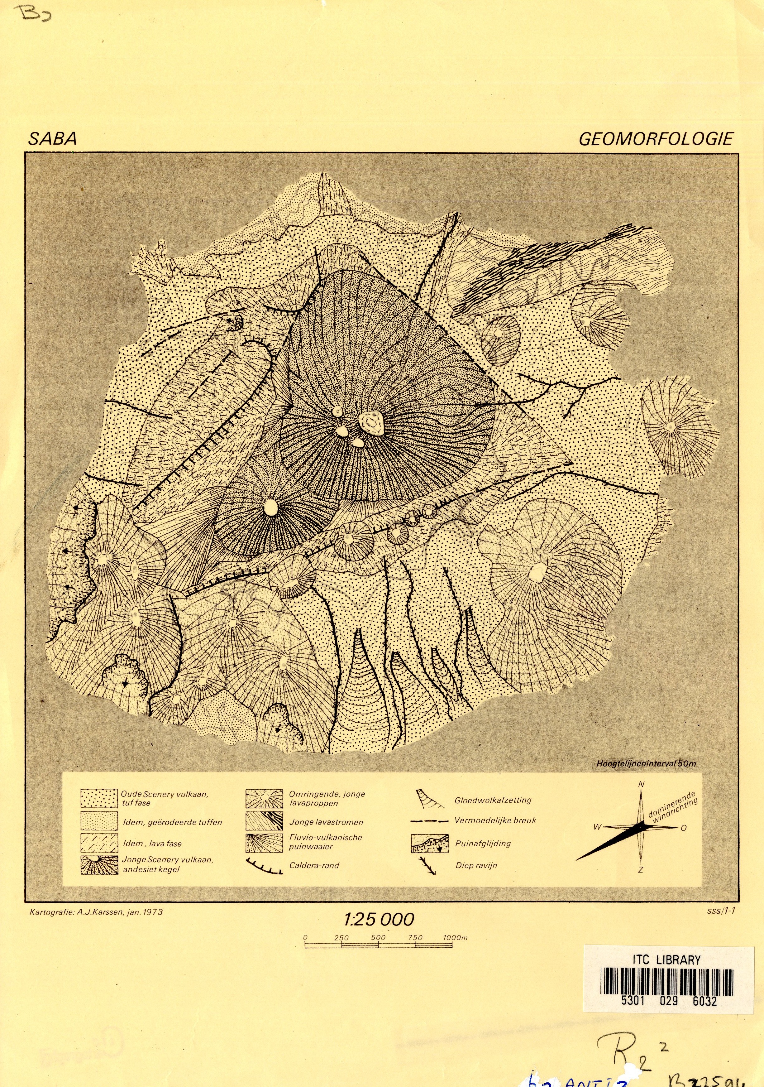
Historical Geomorphological map of Saba (Verstappen)

The Geomorphological map of Saba at a scale of 1:25.000 printed by the cartogrpahy department of the ITC in the Netherlands.

Date
1977
Data type
Maps and Charts
Theme
Research and monitoring
Geographic location
Saba
Image

Historical Geological map of Bonaire (Westerman and Zonneveld)

The geological and land use map of Bonaire displays: topographical features and land use based on aerial photographs and geological formations based on the geological map by Pijpers and an investigation of aerial photographs.
The download includes a hi-resolution scan of the original paper map and a geo-referenced version for use in GIS.

Date
1956
Data type
Maps and Charts
Theme
Research and monitoring
Geographic location
Bonaire
Image

Historical Geological map of Bonaire (Buisonje)

The geological (Younger Cenzoic) map of Bonaire was surveyed in 1956, 1959 and 1960 and includes geological sections at seroe grandi, grita kabai and beneden bolivia.
The download includes a hi-resolution scan of the original paper map and a geo-referenced version for use in GIS.

Date
1956
Data type
Maps and Charts
Theme
Research and monitoring
Geographic location
Bonaire
Image

Historical soil map of Bonaire

The historical soil map of Bonaire has been produced for the ministry of welfare of the government of the netherland antilles as part of the development plan on land and water at a scale of 1:40.000.
The download includes a hi-resolution scan of the original paper map and a geo-referenced version for use in GIS.


Date
1967
Data type
Maps and Charts
Theme
Research and monitoring
Geographic location
Bonaire
Author
Image

BioNews 5 - May 2013

This month’s issue focuses on coral reef restoration efforts; research by SECORE and CARMABI on Curaçao and a private initiative by the Coral Restoration Foundation and Buddy Dive Resort on Bonaire. Since the decimation of Staghorn and Elkhorn coral colonies by whiteband disease in the early 1980s and because of their slow natural recovery rates throughout the Caribbean, there is a strong interest in human-assisted restoration efforts, which may help speed up the natural process of recovery. In addition to coral reef restoration, this edition profiles the ongoing flora monitoring on the Leeward Islands and showcases the historical taxonomic collections from the Dutch Caribbean held at Naturalis Biodiversity Center in Leiden, the Netherlands.

Amongst others, you will find in this fifth issue:

Date
2013
Data type
Media
Theme
Education and outreach
Research and monitoring
Geographic location
Aruba
Bonaire
Curacao
Saba
St. Eustatius
St. Maarten
Author