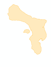
Reference coastline of Bonaire based on Pleiades imagery
Submitted by Peter Verweij on Mon, 04/09/2018 - 12:35Reference map of Bonaire (land / water; GIS). Digitized from Bonaire Pleiades very high resolution satellite imagery (50x50 cm) from 2014-2016.
_BonaireRefPleiades.PNG)
Date
2016
Data type
Maps and Charts
Geographic location
Bonaire