Trail map of Saba
Submitted by Petra van den Broek on Fri, 08/08/2014 - 11:33Trail map of Saba (GIS)

Data type
Maps and Charts
Theme
Research and monitoring
Document
Geographic location
Saba
Central repository for biodiversity related research and monitoring data from the Dutch Caribbean
Trail map of Saba (GIS)
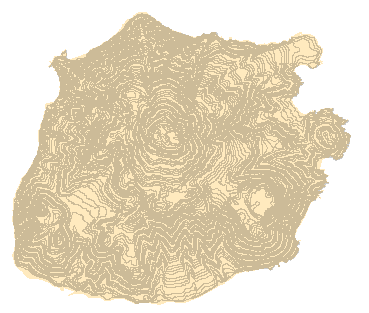
Contour map of Saba (10m interval) based on aerial photograph interpretaion (GIS)
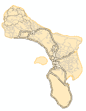
Road map of Bonaire (GIS)
Inland islands map of Bonaire (GIS)


Bathymetry (underwater depth) map for the seas surrounding St Eustatius, Saba and St Maarten (GIS).

