Archaeological Predictive Map Saba, Caribbean Netherlands
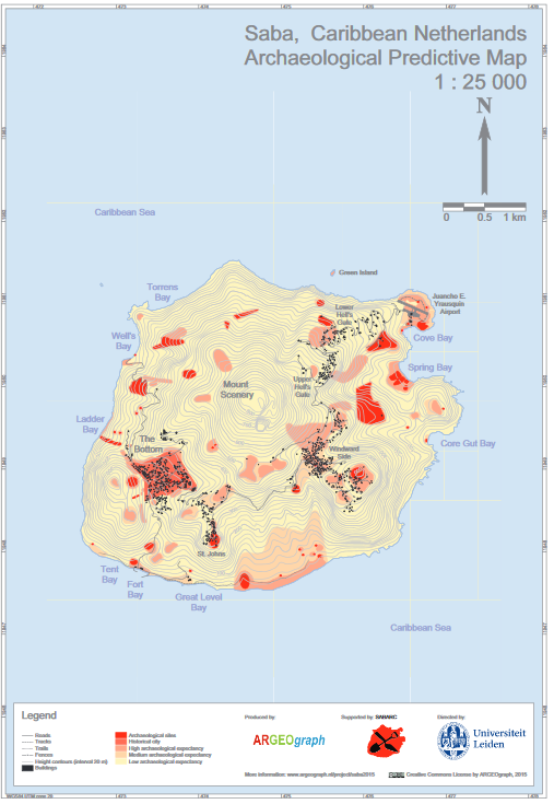
Submitted by Henk Kramer on Fri, 07/03/2015 - 13:35In 2015 ARGEOgraph created the Archaeological Predictive Map of Saba for the Dutch ministry of Education, Culture and Science. This map has been made available to the Saba Archaeological Center (SABARC) and the Sint Eustatius Center for Archaeological Research (SECAR) in GIS format (shape files). The pdf files of the map in A3 (scale 1 : 25 000) and B1 format (1 : 10 000) can be downloaded from the ARGEOgraph website (see URL). Additionally, a colophon presenting information on approach, sources and precision can be downloaded.
Date
2015
Data type
Maps and Charts
Theme
Research and monitoring
Geographic location
Saba