Landschappen van Caribisch Nederland
Submitted by Peter Verweij on Tue, 09/29/2020 - 13:09Over landschap en erfgoed van de voormalige Nederlandse Antillen en Aruba is relatief weinig gepubliceerd.[1] Toch bestaan de banden tussen Nederland en deze eilanden alweer bijna 400 jaar. Bovendien zijn de zes eilanden meer dan ooit verankerd in het Nederlandse staatsverband. Aruba, Curaçao en Sint-Maarten hebben inmiddels alle een ‘status aparte’ binnen het Koninkrijk. De drie andere eilanden, Bonaire, Saba en Sint-Eustatius, vallen sinds 2010 als ‘openbaar lichaam’ rechtstreeks onder Nederland. Kortom, reden genoeg voor het Tijdschrift voor Historische Geografie een themanummer te wijden aan deze zes zeer verschillende eilanden, met als rode draad de zichtbare, maar ook onzichtbare, sporen van de Nederlandse kolonisatie. Hoe, waar en waarom hebben de bewoners en bestuurders ingegrepen in het bestaande landschap en wat zijn daarvan de gevolgen geweest?
David Koren, gastredacteur voor dit nummer, draagt twee artikelen bij over Curaçao. In het eerste artikel analyseert hij de geschiedenis van het plantageverleden van Curaçao dat, behalve in de monumentale landhuizen, nog zichtbaar is in het landschap. In het tweede artikel wordt het moeizame proces van de werelderfgoedvoordracht van het Plantagesysteem van West-Curaçao nader bekeken. Koren draagt argumenten aan om vooral in te zetten op de waarde als cultuurlandschap en minder op de architectuurhistorie van de vier geselecteerde plantagehuizen. Daarbij mag het slavernijverleden niet uit het oog worden verloren.
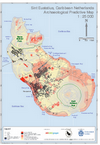
Archeoloog Amy Victorina interviewt haar collega Claudia Kraan over hoe het Verdrag van Malta functioneert als een vehikel om op Bonaire cultuurhistorisch waardevolle landschappen te beschermen, zowel van koloniale- als van prekoloniale oorsprong. De Nederlandse kolonisatie is ook van invloed geweest op lokale bouwtradities, zoals blijkt in het derde artikel van cultuurhistorica Romy van Voren over de gedecoreerde kunuku-huizen (‘cas floria’) op Aruba.
Vervolgens komen de Bovenwindse eilanden aan bod. Dré van Marrewijk en Floortje Aldershoff tonen de bijzondere aanpassingen van de kolonisten aan de topografie van het eiland Saba en het bijzondere erfgoed dat dit heeft opgeleverd. Vervolgens laat archeoloog Ruud Stelten zien dat het erfgoed op Sint-Eustatius ogenschijnlijk ook onzichtbaar kan zijn (maar net niet helemaal). Wim Renkema neemt ons in de rubriek ‘Landschap op papier’ mee naar de uitbreiding van een zoutpan op Sint-Maarten.
Tenslotte geeft Cees van Rooijen daarna zijn visie op het boek ‘Archaeology of Domestic Landscapes of the Enslaved in the Caribbean’. Dit nummer eindigt met een volledig aan de Antillen gewijd Literatuuroverzicht.
Caribisch Nederland heeft in het verleden een belangrijke rol gespeeld in de internationale slavenhandel, een geschiedenis die tot op heden sporen heeft nagelaten in de Caribische en de Nederlandse samenleving. Voor de slachtoffers van de slavernij is internationaal de term ‘enslaved’ gangbaar. In overleg met de auteurs van de artikelen hanteert het THG daarvoor als Nederlandse vertaling: ‘tot slaaf gemaakten’.
Inhoudsopgave
Redactioneel 129
Artikelen
Een eeuwenlange strijd tegen droogte en teloorgang. Uiteenlopende waarden en betekenissen van het Curaçaose plantagelandschap 131
David Koren
Slavernijverleden werpt schaduw vooruit. Werelderfgoedstatus voor Plantagesysteem West-Curaçao? 152
David koren
Interview met Claudia Kraan. Cultuurhistorische landschappen op Bonaire: flexibele en duurzame bescherming van erfgoed 169
Amy Victorina
Getuigen van de Arubaanse geschiedenis en identiteit: de kunuku-huizen en de cas floria 177
Romy van Voren
Saba, de onbedorven koniging van de Antillen 185
Dré van Marrewijk en Floortje Aldershoff
Het onzichtbare verleden van Sint-Eustatius 197
Ruud stelten
Landschap op papier: Een plan voor grootschalige zoutwinning op Sint-Maarten 207
Wim Renkema
Landschapselementen:. Sporen van een indigocultuur op Curaçao 213
Carel de Haseth en François van der Hoeven
Boekbespreking 218
Literatuuroverzicht 221