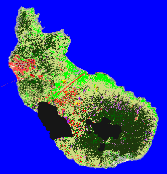
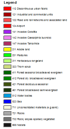
Land cover map of St.Eustatius
The land cover map of St. Eustatius gives a coarse representation of the distribution of forest, shrub, pasture and artificial surface. Invasive species (like Corallita) are included where technically possible. See this report for more information